Rendered at 01:37:20 05/21/25
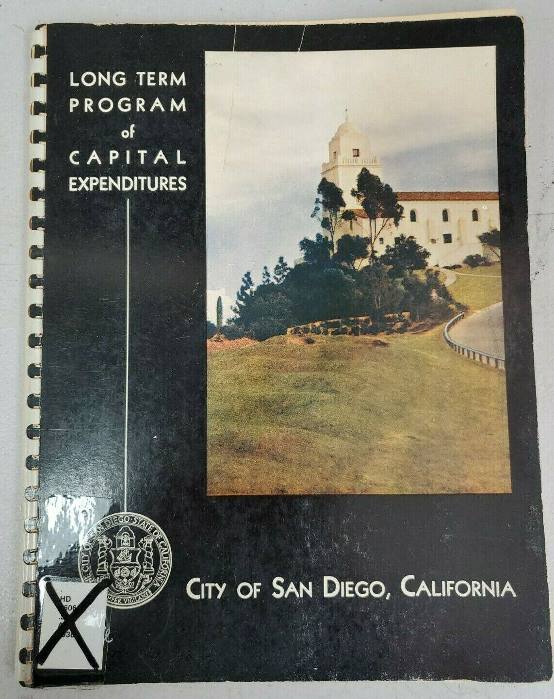


Long Term Program of Capital Expenditures City of San Diego CA 1938 Harbor Drive

Shipping options
Seller handling time is 1 business day Details
$4.50 to United States
Offer policy
OBO - Seller accepts offers on this item.
Details
Return policy
Full refund available within 30 days
Purchase protection
Payment options
PayPal accepted
PayPal Credit accepted
Venmo accepted
PayPal, MasterCard, Visa, Discover, and American Express accepted
Maestro accepted
Amazon Pay accepted
Nuvei accepted
Item traits
| Category: | |
|---|---|
| Quantity Available: |
Only one in stock, order soon |
| Condition: |
Used |
| Country/Region of Manufacture: |
United States |
| Year: |
1938 |
| Theme: |
Cities & Towns |
| Seller Notes: |
Listing details
| Shipping discount: |
Free shipping on orders over $75.00 |
|---|---|
| Posted for sale: |
More than a week ago |
| Item number: |
1061652285 |
Item description
City Planning Commission of San Diego CA
Glenn A Rick, City Planning Engineer
J W Williams, Assistant Engineer
shows street projects for the city
aerial photos of San Diego
information on Harbor fill in project
map of proposed street improvements
map of proposed bridges, underpasses, storm drains and channels
Map of proposed water mains
map of proposed trunk line and intercepting sanitary sewers
Map showing location of fire and police stations and proposed buildings of electrical facilities
Map showing location of proposed recreational and miscellaneous improvements
map showing location and enrollment of public schoools
map showing estimated population in each of the 27 districts
map showing growth in residential units during the 10 year period 1928-1937
Map showing location of canyons and hillside property
map showing location of proposed park and harbor improvements
inside of back cover has fold out map of the major street plan of San Diego
45 pages
comb binding
Added to your wish list!

- Long Term Program of Capital Expenditures City of San Diego CA 1938 Harbor Drive
- 1 in stock
- Price negotiable
- Handling time 1 day.
- Returns/refunds accepted
Get an item reminder
We'll email you a link to your item now and follow up with a single reminder (if you'd like one). That's it! No spam, no hassle.
Already have an account?
Log in and add this item to your wish list.