Entrance to New York Harbor Range Beacon Coast Survey Map 1851
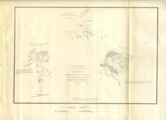
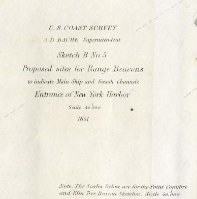
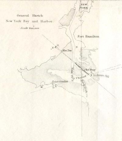
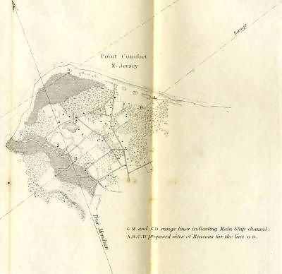

This is Sketch B No 5 from the Sketches Accompanying the Annual Report of the Superintendent of the United States Coast Survey 1851. The map measures about 12" x 9 1/4". There is light wear of the formerly bound edge and a fold line from being in the book. . A very nice historical drawing, that would look great framed. In very fine condition. The Proposed sites for Range Beacons to indicate Main Ship and Swash Channels, Entrance to New York Harbor, 1851.
collectibleOur Policies:
For Multiple Purchases A single payment for all items would be appreciated.
We Ship World Wide Due to the Impact of USPS Policy Changes, Delivery time of some International Packages may be 8 to 18 weeks or more
International Buyers – Please Note:
Import duties, taxes, and charges are not included in the item price or shipping cost. These charges are the buyer's responsibility.
Please check with your country's customs office to determine what these additional costs will be prior to bidding or buying.
STATE Sales Tax Based on Applicable Tax Laws, will calculate and, collect Sales Tax for items shipped to customers in States requiring Sales Tax collection.
You may be interested in our other listings.
